Balk

Blog: El Paraje de las Alpujarras and Sierra Nevada walks · nature · culture · events · publications · weather
blog by: El Paraje
Berchules, Granada, Spain
Showing posts with label acequias. Show all posts

8 August 2011

De Bérchules a Trevélez por el Horcajo

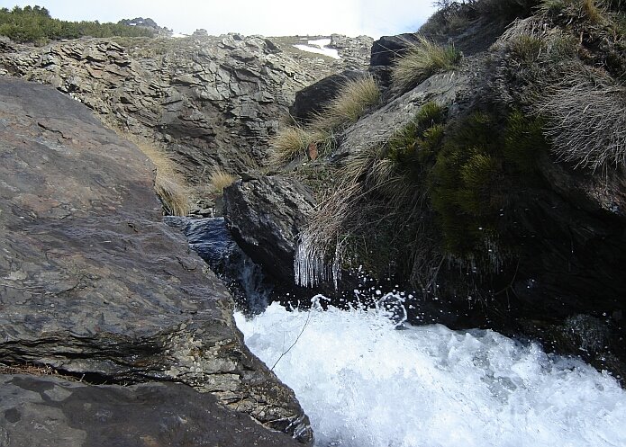
Yesterday we checked out a walking route of 19 km from the Plaza de Lobos above Bérchules to Trevélez. It involves a landrover drop off at 2600m from were you start following an irrigition channel. Right from the beginning you have spectacular views of a number of the high peaks - like the Mulhacén - and you can see Trevélez in the distance. After 4 km you get to the Barranco de las Albardas from which the high Acequia de Bérchules takes part of its water. Another 2 km further on you arrive at the Barranco de Río de Jérez, the origin of the Río Trevelez and with its borreguiles a very lush place. From here you start following another irrigation channel which even in high summer is bordered by green grass and flowers. This part is not suitable for people with fear of hights, because you need to walk on small, steep stretches with loose stones. Southwards you can see on a clear day the sea in the distance and to your right the views of the Alcazaba are impressive. You get to a crossroads with a sign for the Lagunas Vacares and the Puerto de Jérez.  From this point you follow the waymarked Puerto de Jérez route to El Horcajo and from here you walk along the river down to Trevélez. More information on these routes can be found in the small booklet Rutas por Trevélez.
If you are interested in doing this walk to Trevélez, or use the Plaza de Lobos as a starting point for any other route, you can contact us for more information on a landrover ride up to this excellent viepoint. If you just want to spend a few hours high up, something can be arranged as well, just driving up is already a great experience. A nice alternative is to just walk to the Barranco de las Albardas, a great place for butterfly sighting. Here we photographed, amongst others, Dusky Meadow Browns (Hyponephele lycaon), the endemic Spanish Brassy Ringlet (Erebia hispania), Black Satyrs (Satyrus actaea), Dark Green Fritllaries (Argynnis aglaja) and the Large Skipper (Ochlodes sylvanus) with the rolled up proboscis. This photo journey gives an impression of the spectacular route ´Trevélez por el Horcajo´. Here we offer the GPS track of this walk


High mountain walking without climbing, a perfect high summer option.

Related articles:
- Rutas por Trevélez
- Horseback riding with Virgen de las Nieves from Trevélez
- Cerro del Gallo, the highest mountain of Bérchules
- Acequia de Bérchules

Related key words: wandeling, bergwandelen, hiking, trekking, las alpujarras, hooggebergte

8 August 2010

Acequia de Bérchules

There are many irrigation channels in and around our village, but there is only one that carries the name ´Acequia de Bérchules´. This is an irrigation channel that runs for a large part at an altitude of about 2,500 metres. It takes most of its water from the Barranco de las Albardas in the Trevélez valley. It was built more than ten centuries ago by the Arabs. Water transported by this acequia has always been used to supply fountains and for irrigation of the land. After many people left the area in the fifties of the last century, this acequia fell in disrepair as it was no longer maintained. When the Sierra Nevada was declared Parque Nacional in 1999, the restoration of the ´acequias de careo´ in the high parts of the massif was one of its priorities. In the summer of 2006 a group of nine men from our village went up the Plaza de Lobos each day to work on its restauration. Everything was done in the original way, in other words manually. From the mountain slopes great blocks of stone were extracted which were made into thin slates. These slates were then used to restore the irrigation channel. They did a marvelous job. Since a few years water is running through this channel again, and it is fantastic to walk along it. Between the Plaza de Lobos and the Barranco de las Albardas there is little height difference and the views are breathtaking. Our next target is to check out the part from this Barranco de las Albardas to the Río de Puerto de Jérez. If it is possible to continue walking alongside the channel, it could be a new walking connection between Bérchules and Trevélez.


Related article:
- water distribution at cima del tejar

Related links:
- Mecina Bombarón news 25-2-2011: Homenaje a los acequieros
- Taha news 24-2-2011: Homenaje a los acequieros
- Article from La Opinión de Granada, 28th of August 2006: Sierra Nevada recupera 600 kilómetros de acequias
- Google satelite position, where the Acequia the Bérchules takes water from the Barranco de Albardas (the photo is taken just a few meters walking south from the sharp bent.)
-Dina-mar: Galería fotográfica de los Careos de las Alpujarras

1 March 2010

Junta de los Riós circular walk damaged

Our walking route to the Junta de los Ríos is a circular route that returns along the Acequia Nueva as we explained in an earlier post. We had heard that the Acequia Nueva of Bérchules suffered a lot during the recent spells of bad weather. Today we took the opportunity to see the damage with our own eyes. At some parts, the path and the irrigation channel have disappeared completely. At one point it is necesarry to cross a steep slope with loose stones. At other parts you need to be a bit agile and creative to find your way. From an easy leisurely walk the part along the acequia has changed into a challenging route only for experienced walkers. We therefor advise walkers to do the official linear walk that follows the old Camino a Lanteira. It runs a bit higher up and does not give any serious problems. It passes the Fábrica de los Moros where the two rivers join and continues up to Cortijo los Pollos. Go as far as you think you can manage, keeping in mind you walk the same way back.
It is vital that the irrigation channel will be repaired for the farmers in Bérchules and Alcútar that depend on the water from the Acequia Nueva. The restoration will be a mayor project, costly and time consuming. We hope for the farmers that money will become available to start with the repairs soon. We also hope that the restoration project will take into account that the Acequia Nueva is part of the protected heritage as we can see on the list of Bienes de Interés Cultural. Although the circular walk is not advisable at the moment, the beauty of the Bérchules river valley can still be enjoyed following the official linear walk.


related keywords: senderismo, rutas, wandelen, wandelingen, randonnée, promenades, wandern, wanderungen, wandelvakantie, wandelroutes, B&B, hotel

26 April 2009

Water distribution at the Cima del Tejar

This post is a serial to the articles: Publication on the acequias de careo from the Alpujarra and Walking along the Acequia de Mecina.
In the Guidebook on the Gran Recorrido Sendero Sulayr published by Editorial Penibética, there is a text on the Acequia de Mecina. It says that it is worthwhile to follow the water down on the days that the ´acequiero´ is distributing the water at the different simas. A sima or cima is a flat area where the water finally infiltrates.
We called the acequiero responsible for this careo canal to ask which days the water would run down as far as the Cima del Tejar where the Acequia de Mecina ends. He explained that this is in the spring four days a month, and that the 25th of April would be next day.
So yesterday with the sound of the music and fireworks of the San Marcos festivities coming up from Bérchules, we walked up. About forty metres below the cima, we heard the beautiful sound of water. We couldn´t believe our eyes when we walked further up. The sight of swampy green grass and small waterfalls and streams everywhere was magnificent.
It is amazing to give it a thought that this ingenious system has enabled people to drink water from the fountains in the village of Mecina Bombarón for at least a thousand years. The profession of acequiero has existed from the Muslim period up to the present. These are the persons that are authorised to control the floodgates and that are in charge of distributing the water at the different simas. We did not have the chance to meet the acequiero of the Acequia de Mecina yesterday, but this is a good reason to walk up another day when ´le toca el agua´ again. As we think that the system of this acequia de careo is really something you should see instead of read about, we made a selection of photos. These photos illustrate the system from the beginning – where it starts taking water from the Río Grande de Bérchules – to 7,5 kilometres further down, just below the Cima del Tejar where the water is distributed.


Related links:
-Dina-mar: Galería fotográfica de los Careos de las Alpujarras

14 April 2009

Club Unesco Alpujarra organizes Jornadas ´El Agua en La Alpujarra´

A new institution ´Club Unesco de la Alpujarra granadina´ has been founded and was presented on the 20th of March in Órgiva. The volunteers will dedicate themselves to different causes that are related to the environment, the natural and cultural heritage, culture and education. This club is under the auspices of the ´Centro Unesco de Andalucía´ and is part of the centres that are supported by the international organization Unesco. The chairman of the Centro Unesco de Andalucía is Miguel Carrasco, born in Órgiva, he is proud that the Alpujarra club is one of the first to be constituted. This is what we can read in the newspaper article ´El Club Unesco de la Alpujara empieza su andadura para trabajar por la comarca´ published in Granada Hoy on the 24th of March 2009. At the end of this article it is said that the first event organized by this local Unesco club, in cooperation with the Asociación Cultural Abuxarra, will be a conference on the water of the Alpujarra. This conference will take place in Pitres on the 17th and 18th of April 2009. The acequias will be one of the important topics of the different speeches as we can see on the programme of these Jornadas ´El Agua en la Alpujarra´.

1 April 2009

Publication on acequias "The ´Careos´ from Alpujarra"

There are two types of acequias to be found in the Alpujarras, there are ´acequias de riego´ irrigation canals and there are ´acequias de careo´. The ´acequias de careo´ fill aquifers so that the springs keep flowing in the dry months. At the same time they generate pastures - ´carear´ means to guide the livestock to graze - which explains the name of this type of canal. The ´Acequia de Mecina´, about which we wrote in our last post, is an ´acequia de careo´.
While looking for more information on acequias we found out that in December 2005 an interesting paper was written on the ´acequias de careo´ or ´careos´ canals as they are called in this essay. In 2006 an abstract of this Spanish thesis was published in the Revista de Ciencia, Tecnolgía y Medio Ambiente, called Technolgi@ y Desarrrollo. An English version of this paper on the ´careos´ can be found on the internet as well. The title of the Englis version is ´The ´careos´ from Alpujarra (Granada, Spain), a historical example of artificial recharge previous to XIII century applicable to the XXI century, characterization and inventory.´ This paper is written by A. Enrique Fernández Escalante, Manuel García Rodríguez and Fermín Villarroya Gil and arose from the Ph.D. thesis of the first author.
In the paper it is explained that these canals are traditionally dug in soils or rock, and are used like a technique for artificial recharge of aquifers in the Alpujarra area, mainly by means of waters of thaw of the Sierra Nevada range. It says that their origin goes back to at least the year 1139, but that its most extensive employment was reached in the last centuries of the Muslim time, XIII to XV centuries, when an intricate canilisation system was developed for the maximum use of the water. ´Careos´ canals facilitate the infiltration of the water. The water of the rivers and streams is diverted by these canals during the winter and the spring, to the flat areas where it infiltrates. Each canal has its areas of recharge called ´simas´ or ´cimas´. The investigators classified and defined a total of 23 ´careos´ canals. They state that the Acequia de Mecina is the largest to be found in the Sierra Nevada, that it is well-developed, well-conserved and that it has twenty ´simas´ were the water is distributed. One of the conclusions in the paper is: "It would be important to preserve and to maintain these systems of careos, given their high historical and environmental value." We think this paper to be very informative and we are glad that local authorities are each time more aware of the importance of these canals that have been operative for at least eight centuries. Since the declaration of Sierra Nevada as Parque Nacional y Natural in 1999, the program to recuperate the canals has been given high priority. "Where would we be without them?" in other words: ¡Si no fuera por ellas!, says the sign along the Acequia de Mecina.Sign along the Acequia de Mecina explains the importance of the canals with the exclamation ¡Si no fuera por ellas! - foto: casa rural El Paraje

Walking along the ´Acequia de Mecina´

In an earlier post, we wrote that the local circular walk ´Junta de los Ríos´ has been changed into a linear walk. This new walk follows the ´Camino a Lanteira´ to the Junta de los Ríos. Instead of following the irrigation channel ´acequia nueva´ back to the village, it continues six kilometres northwards passing numerous ´cortijos´ or farm buildings. The threshing circles are no longer used, but tomatoes and beans are grown here, there are some fruit orchards and there are a few farms for cattle breeding. After having ascended 620 metres over ten kilometres in distance, you arrive at Cortijo de los Pollos. This cortijo is at an altitude of 1,944 metres one of the highest situated farms of Bérchules. Next to this cortijo, you find a sign saying ´Fin de Sendero Local´ , in other words ´End of the Local Walk´.
As we do not like linear walks ourselves, we were challenged to see whether we could continue from here and make a loop. We found out that by following an abandoned water channel behind this farm building, we could connect to the path along the Acequia de Mecina close to where it starts taking water from the Río Grande de Bérchules. Then we knew we had found a possibility to make a circular route. By following this canal down for 7,5 kilometres we could then connect to the GR-7 to get back to the village. We did this route when there was no meltwater running down, and were curious to actually see the system functioning. Today we took the opportunity and saw water running in the first four kilometres. This is the part from where it starts taking water from the river to a branch just above the ´pista alta´ and Cortijo de Fuente Merino. Altough there was no water running from this point to the Cima del Tejar, it is still a pleasure to simply enjoy its beauty. The Acequia de Mecina is well conserved and suplies water to the village of Mecina Bombarón. It is one of the most impressive canals in the Alpujarreas that we know and it is fascinating to imagine that it has been operative from the Muslim period. Our ´Acequia de Mecina´ route has a total length of almost 24 kilometres, four kilometres longer than walking the same way back of the Junta de los Ríos linear walk, but much more interesting.
Close to the beginning of the Acequia de Mecina that takes water from the Río Grande de Bérchules - foto: casa rural El Paraje

11 December 2008

Sendero Local ´Acequias de Bérchules´

The early snowfall is rapidly forgotten when the sun comes out and makes winter as good as any season for keen walkers. Today we went out to check one of the local circular walks (Sendero Local) ´Las Acequias de Bérchules´ which follows the ´acequia real´. Apart from gathering the GPS data to draw an accurate map, it allows us to update the walking descriptions we offer our guests. This relatively easy walk (3 hours) alllows you to enjoy the impressive Sierra Nevada hinterland and the stunning views over the Alpujarras valley. This surely is one of the aspects that makes Bérchules so interesting for walkers. Note that the waymarking to leave the village is scarce. Later on you will find a mixture of old yellow-white marker posts as well as new green-white marker posts, indicating the same walk.
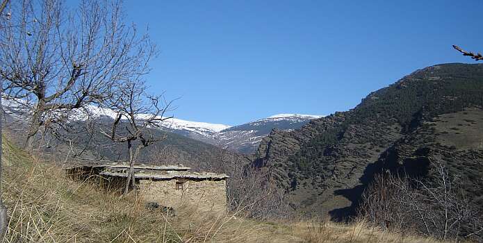
The Sendero Local de las Acequias de los Bérchules passes this mountain cortijo above Bérchules close to Pago Purchena - foto casa rural El Paraje