For trail walking through the Alpujarras, only occasionally it is possible to use camping sites.
For the GR240 only the Trevélez camping lies on the route. Using the few refuge huts and wild camping (or a lot of extra kilometres) are the only solutions. See this special article on the GR240 with all stages.
For walking the GR7 through the Alpujarras, there are campings in Órgiva, Pitres, Trevélez and Laroles.
See this page with all GR7 stages in the Alpujarras from the website Mancomunidad de municipios de la Alpujarra Granadina.
For walking the GR142 there are four campings on the route, Órgiva, Pitres, Láujar de Andarax and Fondón. They are not always on a convenient stage distance. Lodgings therefore also need to be found in hotels and Bed and Breakfasts.
This article lists campsites in the Alpujarras with link to their websites. Behind each camping there is a link to its entrance in campings.net website with good maps with their exact location.
FONDÓN
Camping Puente Colgante - campings.net - on the GR142
LAROLES (municipality NEVADA)
Camping Alpujarras - campings.net - on the GR7
LÁUJAR DE ANDARAX
Campings Cortijo la Molineta - campings.net - on the GR142
ORGIVA
Camping Puerta de la Alpujarra - campings.net - 1 km off the GR142, 10 km off the GR7
Camping Órgiva - campings.net - 3 km off the GR142, 13 km off the GR7
PITRES
Camping El Balcon de Pitres - campings.net - on the GR7, 2 km off the GR142
TREVÉLEZ
Camping Trevélez - campings.net - 1 km off the GR7 - 1km off the GR240
MAP GR240 south
MAP GR7
MAP GR142
Maps from Guía Turistica de La Alpujarra Granadina
Related articles:
- List of the Alpujarran villages with links to the town hall websites
Related links:
- Alpujarras campings working together on facebook
related keywords: kamperen, kampeerplaats, accommodation, wandelen, trekking, hiking, camping, vakantie, kampeervakantie, wandelvakantie
Balk
 | Blog: El Paraje de las Alpujarras and Sierra Nevada
walks · nature · culture · events · publications · weather
blog by:
El Paraje Berchules, Granada, Spain | 
|
Showing posts with label sulayr. Show all posts
Showing posts with label sulayr. Show all posts
8 April 2010
6 April 2010
Sulayr GR240 introduction and links
We would like to dedicate an article to the Sulayr or GR240, anticipating questions we get from people that are thinking about walking this Long Distance Footpath. It will be a dynamic post, as we will add more information as we think this to be relevant.

SULAYR IN THIS BLOG
We have made an index label Sulayr in order to list all articles related to the Sulayr in this blog. Off course this article will show up somewhere in the chain as well.
In order to only view the article, titles scroll down in the tabel of contents until you find GR240 or Sulayr. From there you can click to go to the whole article.
INTRODUCTION
As an introduction we have extracted the module GR240 Sulayr from our website http://www.elparaje.com/.
Use the pointing hand at the bottom right to go to the next page !!
OFFICIAL WEBSITE
This is the official website of the Junta de Andalucia - Medio Ambiente on the Sulyar. Only partly available in English. In the chapter stages we link to pages within this site.
STAGES or TRAMOS
The stages are arbitrary. The majority starts and ends in the middel-of-nowhere. You might need to add the kilometres and the time to access the route from a village.
Nevertheless the stages are useful to describe the route. On the website of the Junta de Andalucía you will find this list of all stages all with links to their individual description and map. Below we already sorted the links per stage.
Tramo 01: Centro de visitantes ´Dornajo´- Casa forestal ´La Cortijuela´ (14,7 km; begins 1 km from hotel el Dornajo)
Tramo 02: Casa forestal ´La Cortijuela´ - Rinconada de Nigüelas (19,4 km)
Tramo 03: Rinconada de Nigüelas - Tello (15 km)
Tramo 04: Tello - Puente Palo (8,7 km)
Tramo 05: Puente Palo - Capileira (10,5 km; ends in village Capileira)
Tramo 06: Capileira - Trevélez (17,4 km; begins in village Capileira , ends in village Trevélez)
Tramo 07: Trevélez - Lastonar (24,9 km; begins in village Trevélez)
Tramo 08: Lastonar - Fuente del Espino (16,5 km)
Tramo 09: Fuente del Espino - Barranco Riachuelo (20,6 km; Posada de los Arrieros 1km up the main road)
Tramo 10: Barranco Riachuelo - El Cerecillo (15,2 km)
Tramo 11: El Cerecillo - La Polarda (20,7 km; ends 1 km from Vivac de la Polarda)
Tramo 12: La Polarda - La Roza (16,9 km; begins 1 km from Vivac de la Polarda)
Tramo 13: La Roza - Piedra Negra (11,2 km)
Tramo 14: Piedra Negra - El Toril (19,2 km)
Tramo 15: El Toril - Las Chorreras (10,2 km; albergue Puerto de la Ragua or this web half way, quite off track)
Tramo 16: Las Chorreras - Postero Alto (21,4 km; ends in fully equiped refugio Postero Alto)
Tramo 17: Postero Alto - Peña Partida (16 km; begins in fully equiped refugio Postero Alto)
Tramo 18: Peña Partida - La Hortichuela (14,5 km)
Tramo 19: La Hortichuela - Centro de Visitantes ´El Dornajo´ (17,1 km; ends 1 km from hotel el Dornajo)
GPS TRACKS DETAILS
We would like to mention that all credits go to the walkers and cyclists that put the GPS information on the internet to share their enthousiasm!
The complete trail on wikiloc by Santiago Sánchez Legaza who did the route on mountain bike. He also made a complete altitude profile and map which you can also see on his forum. (thanks Santiago!)
Stage 1 on wikiloc by multicolor
Stage 2 on wikiloc by zimbo
Stage 3 on wikiloc by zimbo
Stage 4 on wikiloc by zimbo or by trosdejos
Stage 5 on wikiloc by zimbo or by trosdejos
Stage 6 on wikiloc by zimbo
Stage7 on wikiloc by zimbo
Stage 8 on wikiloc by zimbo
Stage 12 on wikiloc by pacoxix
Stages 12 and 13 (with circular walk connection over the Cerro del Buitre) by trosdejos
we have not found individual tracks of the stages 14, 15 16, 18 and 19
Stage 17 on wikiloc by trosdejos
BOOKS or LIBROS
- English topo guide on the Sulayr
- Spanish topo guide on the Sulayr
- Sulayr Los Caminos de la Luz (photo book Penibética)
- All stage descriptions and maps by Nevasport (a Spanish summary on rapidshare)
FREE CAMPING or ACAMPADA LIBRE
The Sierra Nevada Parque Nacional has put its camping guidelines in this paper: normativa de acampada. Officially you have to inform the park authorities on your camping plans. This is the paper you need to fill in: notificación de acampada nocturna
MAPS
Use the scroll bars to move the map.
map from Guía Turistica de La Alpujarra Granadina
Related links:
http://www.senderosulayr.es/ a Spanish blog with Sulayr related articles
related keywords:
books, boeken, livries, buchern, sendero, footpath, langeafstandwandelpaden, lange-afstand-wandelpaden, LAW, Grote Routepaden, Sentier de Grande Randonée, GR-Fernwanderwege, wandelen, wandern, mapa, kaart, alpujarras, trektocht, B&B, hotel
SULAYR IN THIS BLOG
We have made an index label Sulayr in order to list all articles related to the Sulayr in this blog. Off course this article will show up somewhere in the chain as well.
In order to only view the article, titles scroll down in the tabel of contents until you find GR240 or Sulayr. From there you can click to go to the whole article.
INTRODUCTION
As an introduction we have extracted the module GR240 Sulayr from our website http://www.elparaje.com/.
Use the pointing hand at the bottom right to go to the next page !!
OFFICIAL WEBSITE
This is the official website of the Junta de Andalucia - Medio Ambiente on the Sulyar. Only partly available in English. In the chapter stages we link to pages within this site.
STAGES or TRAMOS
The stages are arbitrary. The majority starts and ends in the middel-of-nowhere. You might need to add the kilometres and the time to access the route from a village.
Nevertheless the stages are useful to describe the route. On the website of the Junta de Andalucía you will find this list of all stages all with links to their individual description and map. Below we already sorted the links per stage.
Tramo 01: Centro de visitantes ´Dornajo´- Casa forestal ´La Cortijuela´ (14,7 km; begins 1 km from hotel el Dornajo)
Tramo 02: Casa forestal ´La Cortijuela´ - Rinconada de Nigüelas (19,4 km)
Tramo 03: Rinconada de Nigüelas - Tello (15 km)
Tramo 04: Tello - Puente Palo (8,7 km)
Tramo 05: Puente Palo - Capileira (10,5 km; ends in village Capileira)
Tramo 06: Capileira - Trevélez (17,4 km; begins in village Capileira , ends in village Trevélez)
Tramo 07: Trevélez - Lastonar (24,9 km; begins in village Trevélez)
Tramo 08: Lastonar - Fuente del Espino (16,5 km)
Tramo 09: Fuente del Espino - Barranco Riachuelo (20,6 km; Posada de los Arrieros 1km up the main road)
Tramo 10: Barranco Riachuelo - El Cerecillo (15,2 km)
Tramo 11: El Cerecillo - La Polarda (20,7 km; ends 1 km from Vivac de la Polarda)
Tramo 12: La Polarda - La Roza (16,9 km; begins 1 km from Vivac de la Polarda)
Tramo 13: La Roza - Piedra Negra (11,2 km)
Tramo 14: Piedra Negra - El Toril (19,2 km)
Tramo 15: El Toril - Las Chorreras (10,2 km; albergue Puerto de la Ragua or this web half way, quite off track)
Tramo 16: Las Chorreras - Postero Alto (21,4 km; ends in fully equiped refugio Postero Alto)
Tramo 17: Postero Alto - Peña Partida (16 km; begins in fully equiped refugio Postero Alto)
Tramo 18: Peña Partida - La Hortichuela (14,5 km)
Tramo 19: La Hortichuela - Centro de Visitantes ´El Dornajo´ (17,1 km; ends 1 km from hotel el Dornajo)
GPS TRACKS DETAILS
We would like to mention that all credits go to the walkers and cyclists that put the GPS information on the internet to share their enthousiasm!
The complete trail on wikiloc by Santiago Sánchez Legaza who did the route on mountain bike. He also made a complete altitude profile and map which you can also see on his forum. (thanks Santiago!)
Stage 1 on wikiloc by multicolor
Stage 2 on wikiloc by zimbo
Stage 3 on wikiloc by zimbo
Stage 4 on wikiloc by zimbo or by trosdejos
Stage 5 on wikiloc by zimbo or by trosdejos
Stage 6 on wikiloc by zimbo
Stage7 on wikiloc by zimbo
Stage 8 on wikiloc by zimbo
Stage 12 on wikiloc by pacoxix
Stages 12 and 13 (with circular walk connection over the Cerro del Buitre) by trosdejos
we have not found individual tracks of the stages 14, 15 16, 18 and 19
Stage 17 on wikiloc by trosdejos
BOOKS or LIBROS
- English topo guide on the Sulayr
- Spanish topo guide on the Sulayr
- Sulayr Los Caminos de la Luz (photo book Penibética)
- All stage descriptions and maps by Nevasport (a Spanish summary on rapidshare)
FREE CAMPING or ACAMPADA LIBRE
The Sierra Nevada Parque Nacional has put its camping guidelines in this paper: normativa de acampada. Officially you have to inform the park authorities on your camping plans. This is the paper you need to fill in: notificación de acampada nocturna
MAPS
Use the scroll bars to move the map.
map from Guía Turistica de La Alpujarra Granadina
Related links:
http://www.senderosulayr.es/ a Spanish blog with Sulayr related articles
related keywords:
books, boeken, livries, buchern, sendero, footpath, langeafstandwandelpaden, lange-afstand-wandelpaden, LAW, Grote Routepaden, Sentier de Grande Randonée, GR-Fernwanderwege, wandelen, wandern, mapa, kaart, alpujarras, trektocht, B&B, hotel

4 March 2010
English edition Sendero Sulayr or GR240
At the end of 2009, the Editorial Penibética published an English editition of the GR240, the Long Distance Footpath that circles the Sierra Nevada. Stanford in England and Pied-a-Terra in the Netherlands offer this book on-line.
The Sulayr is a circular LDP, of about 300 kilometres, which is divided into 19 sections. Most trail sections start or end in the middle-of-nowhere. You therefore need to be quite fit to walk the many extra kilometres to find accommodation if you do not want to camp high up. As far as we know, there are two organizations that offer guided or self-guided Sulayr walks; either the whole tour or sections of it. One is the Spanish company Nevadensis in Pampaneira and the other is the English company Spanish Highs based in Lanjarón.
For those who are interested in doing a part of the route on the southern slopes, we give a few ideas. Our suggestion would be to start in Capileira as this town can be reached by public transport. The first walking day you cover the beautiful section to Trevélez, a village with a wide choice of accommodations. We personally like hotel La Fragua as they also offer good food. From Trevélez it is 25 kilometres to the Loma de Lastonar. For those who find this too long, they could split this section up, by walking down to El Paraje from Hoya Herrera. Next morning we could take you up to this point from where you can walk on to the Loma de Lastonar. Our Dutch colleagues Yvonne and Jo of Casa Bombarón in Mecina Bombarón can pick you up at this point and bring you up again the morning after. They can do the same for the next section so that you could consider staying at their B&B for two nights. They like walking themselves and know the area above Mecina Bombarón well enough to give advise on the walks. Then we suggest you contact our English colleagues David and Emma of Las Chimeneas in Mairena to cover the sections that pass through the sierra above their village as they also offer 4x4 transfers. Las Chimeneas in Mairena is a gorgeous accommodation and their restaurant can certainly be recommended. You can contact us if you want to know the mileage that will be charged, or for any other questions you might have on this challenging LDP.
Related links:
- articles on the GR240 on this weblog
- Sulayr information on the website of the Junta de Andalucía.
related keywords: senderismo, rutas, wandelen, wandelingen, randonnée, promenades, wandern, wanderungen, libros, books, boeken, livres, bücher
The Sulayr is a circular LDP, of about 300 kilometres, which is divided into 19 sections. Most trail sections start or end in the middle-of-nowhere. You therefore need to be quite fit to walk the many extra kilometres to find accommodation if you do not want to camp high up. As far as we know, there are two organizations that offer guided or self-guided Sulayr walks; either the whole tour or sections of it. One is the Spanish company Nevadensis in Pampaneira and the other is the English company Spanish Highs based in Lanjarón.
For those who are interested in doing a part of the route on the southern slopes, we give a few ideas. Our suggestion would be to start in Capileira as this town can be reached by public transport. The first walking day you cover the beautiful section to Trevélez, a village with a wide choice of accommodations. We personally like hotel La Fragua as they also offer good food. From Trevélez it is 25 kilometres to the Loma de Lastonar. For those who find this too long, they could split this section up, by walking down to El Paraje from Hoya Herrera. Next morning we could take you up to this point from where you can walk on to the Loma de Lastonar. Our Dutch colleagues Yvonne and Jo of Casa Bombarón in Mecina Bombarón can pick you up at this point and bring you up again the morning after. They can do the same for the next section so that you could consider staying at their B&B for two nights. They like walking themselves and know the area above Mecina Bombarón well enough to give advise on the walks. Then we suggest you contact our English colleagues David and Emma of Las Chimeneas in Mairena to cover the sections that pass through the sierra above their village as they also offer 4x4 transfers. Las Chimeneas in Mairena is a gorgeous accommodation and their restaurant can certainly be recommended. You can contact us if you want to know the mileage that will be charged, or for any other questions you might have on this challenging LDP.
Related links:
- articles on the GR240 on this weblog
- Sulayr information on the website of the Junta de Andalucía.
related keywords: senderismo, rutas, wandelen, wandelingen, randonnée, promenades, wandern, wanderungen, libros, books, boeken, livres, bücher
23 February 2010
Luces de Sulayr, images of Sierra Nevada
To celebrate the tenth anniversary of Sierra Nevada as National Park, there was an exhibition organised called ´Luces de Sulayr´ at the Centro Cultural de la Caja de Granada in Granada. ´Sulayr´ or ´Mountain of Sun´ as the Arabs called the Sierra Nevada has served as a source of inspiration for many artists, painters and writers. Apart from paintings, books and photographs, there is also a lot of unique material of botanists and cartographers. For the exhibition ´Lights of the Sulayr´ the most interesting images of the past five centuries were brought together. The exhibition was closed three weeks ago, but a virtual visit of ´Luces de Sulayr´ is still possible. This comprehensive website offers many paintings, photographs, soundtracks, maps and digitalised books from 16th century up to recent publications. To discover the content of this website is an adventure in it´s own and worth the effort. While glancing through one of the books, we came for example across this drawing of Bérchules from 1752! On this drawing the churches and mills can be observed, acequias and barrancos, but also the cultivated terraces like vineyards. This drawing is incorporated in the Álbum Cartográfico de Sierra Nevada 1606-1936 , by Javier Piñar and Manuel Titos (1995). 
Related links.
- exposition catalogue: Luces de Sulayr, cinco siglos en la imagen de sierra nevada (or catalogos de exposicion)
Related links.
- exposition catalogue: Luces de Sulayr, cinco siglos en la imagen de sierra nevada (or catalogos de exposicion)
24 June 2009
Walking in high summer 2009
´El Paraje´ is situated at 1,400 metres and is therefore always cooler than the coast or the cities. Nevertheless it can be quite warm for serious walking in the summer. We advise people to leave early and enjoy the higher parts of the Sierra Nevada. A recently tested summer walk climbs from Trevélez up to the Alto del Chorillo at 2,720 metres. With fantastic views on the Poqueira valley, it takes the path south into the direction of Alto del Portillo. Before reaching this point, at about 2,400 metres it connects with the ´pista forestal´. Following this track down 2 kilometres it connects with the GR240 or Sulayr at the Prados de las Juncias. The Sulayr brings you back to Trevélez. This proofed to be a beautiful circular walk of about 25 kilometres. With a map of the area it is possible to do this walk as there a wooden posts almost all along the way. A descripton is therefore not really needed.
28 August 2008
Sendero Sulayr Tramo 8
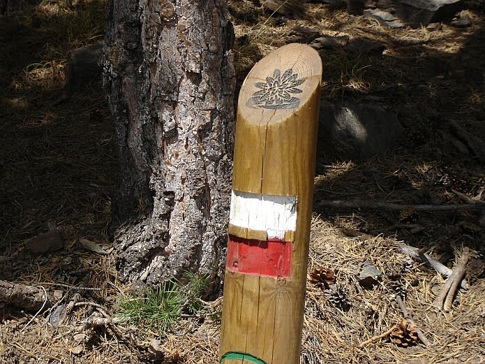
Today we checked out one of the less accessible sections of the Sendero Sulayr. Tramo 8 starts in the middle of nowhere at the Loma de Lastonar and ends in the middle of nowhere at the Fuente del Espino and is 16,5 kilometres long. If you´re not bivouacking high up, you need a transfer with a fourwheel drive as the dirt track from Mecina Bombarón is in a regular state. The access to the GR240 is badly indicated so you need to follow the GR7 signs for about 4 kilometres to find the first Sulayr marker post.
Once you´re up the views are spectacular and the walking is a joy for the first 10 kilometres. The route takes you through beautiful scenery and is well signposted. Going down towards the Río de Mecina you need to pay attention. Large flocks grazing here have made many paths and the marker posts are scarce. On the Cuesta del Diezmadero the signs have fallen off and are incorrect. The Fuente del Espino is still further away than the 2,9 kilometres indicated. After having crossed the Acequia de Válor the track has become overgrown. After having crossed the Río de Válor the marker post at a crossing of dirt tracks indicate again a wrong number of kilometres and the climb up the Peñón de la Loma is poorly waymarked. Having reached the end of the section at the Fuente del Espino, the nearest village is still 16 kilometres away. As there´s no mobile coverage in this area, contact with somebody in order to change the appointment for a transfer is impossible. So if anything doesn´t work out as planned you could get into a difficult situation. Walking all the way down would not be the most attractive ending of a splendid day high up in the mountains.
Note: the maps of the guidebook and of the Junta de Andalucía of this section do not coincide. The route as drawn on the map in the Penibética guidebook is the correct one.
Related articles
- Special about the Sulayr
Once you´re up the views are spectacular and the walking is a joy for the first 10 kilometres. The route takes you through beautiful scenery and is well signposted. Going down towards the Río de Mecina you need to pay attention. Large flocks grazing here have made many paths and the marker posts are scarce. On the Cuesta del Diezmadero the signs have fallen off and are incorrect. The Fuente del Espino is still further away than the 2,9 kilometres indicated. After having crossed the Acequia de Válor the track has become overgrown. After having crossed the Río de Válor the marker post at a crossing of dirt tracks indicate again a wrong number of kilometres and the climb up the Peñón de la Loma is poorly waymarked. Having reached the end of the section at the Fuente del Espino, the nearest village is still 16 kilometres away. As there´s no mobile coverage in this area, contact with somebody in order to change the appointment for a transfer is impossible. So if anything doesn´t work out as planned you could get into a difficult situation. Walking all the way down would not be the most attractive ending of a splendid day high up in the mountains.
Note: the maps of the guidebook and of the Junta de Andalucía of this section do not coincide. The route as drawn on the map in the Penibética guidebook is the correct one.
Related articles
- Special about the Sulayr
22 August 2008
Sendero Sulayr Tramo 6
The most accessible section of the Sendero Sulayr is Tramo 6. It links Capileira with Trevélez and there´s a bus connection between these two villages. The total length of this stretch is 17,4 km with a height difference of about 920 m. The Penibética guidebook describes this section from west to east, so starting in Capileira, but we tried out if the reverse gives any problems in finding the route. It turned out that only on leaving Trevélez it is not so clear where to pick up the route. Knowing that within a kilometre the GR7 and the GR240 join each other on a dirt track, it is not a problem to follow the red-and-white waymarks of the GR7 on leaving Trevélez. Apart from this, it is a well waymarked stretch that can also be walked from east to west without a description. The map from the guidebook of this Gran Recorrido might be useful though. It´s a diverse section, as you walk on broad tracks as well as on small paths, through open terrain as well as through pine and oak woods. One of the attractive aspects of this stretch is its impressive vastness of space.

Related articles:
- Special about the Sulayr
Related articles:
- Special about the Sulayr
10 August 2008
GR 240 Sendero Sulayr
Today we incorporated some information on the Sendero Sulayr into our website. This Long Distance Path, the GR240, circles the Sierra Nevada. It was inaugurated in 2007, and this same year a Spanish guidebook on this trail was published. We are about 6 kilometres away from the Sulayr, halfway stage 7. This stage that connects Trevélez and the Loma de Lastonar has a total length of 24,9 kilometres. On our website you can find information on how to get to our Casa Rural from the Sulayr or vice versa. Having a look at the website of the Junta de Andalucía or at the guidebook, you can see that most stages end or begin in the middle-of-nowhere, like at the Loma de Lastonar above Bérchules. It´s therefor interesting to know that overnight camping is allowed with prior written notification. This form "notificación de acampada nocturna" needs to be send to the Park authories. Please take notice of the leaflet "normativa de acampada" on which you can find the norms regarding bivouacking.
10 January 2008
Information on GR240 from our website www.elparaje.com
Here we have extracted the module GR240 Sulayr from our website http://www.elparaje.com/.
Use the arrow at the bottom right to go to the next page!
Use the arrow at the bottom right to go to the next page!
Subscribe to:
Posts (Atom)