
Balk
 | Blog: El Paraje de las Alpujarras and Sierra Nevada
walks · nature · culture · events · publications · weather
blog by:
El Paraje Berchules, Granada, Spain | 
|
Showing posts with label gr7. Show all posts
Showing posts with label gr7. Show all posts
13 December 2013
Walking the GR7 in Andalucía, a Cicerone Guide

14 April 2011
Bérchules - Trevélez - Bérchules
The part of the Alpujarras between Bérchules and Trevélez is quite interesting for walkers. The GR7 route connects Juviles and Trevélez and there are a few possibilities to pick up this route from Bérchules and of course from El Paraje. Thanks to the ALSA bus service, it can be done as a linear walk (another option is to organize a taxi transfer).
For keen and fit walkers we offer a special connection with Trevélez (our ´high´ route) that does not bend around the mountains but that goes right over them, passing the Peña de los Papos at 2,535 metres.
If you prefer circular walks, or if you like trail running, you may consider combining the two. This leads to a 32 kilometres walk or run that really is spectacular.
This route connects El Paraje (01) with the pista forestal (06-09) that also can be reached using the access dirt track to the sendero Sulayr Gr240 from the Cruz the Juviles.
(At 04 you can choose a less steep option going west on the dirt track and connecting lower down with the pista forestal. This may be a good option for runners, see map)
From point 09 to 13 a single track leads through the pìne woods, almost up to the ridge. You follow the ridge until 15, take a small track right until 16 after which you cross the barranco. Descend to the pine woods (19) and along those pine woods to a water reservoir (19) of a small farm house. Descend over a meadow another 400 metres to the border of another pine forest (20 chalk crosses on big stones!). A clear track zigzags down and connects with the GR7 (21).
From 21 to 27 the GR7 is well waymarked. At point 24 the Sulayr goes left steeply up, while we continue straight on. Where the single track of the GR7 reaches a dirt track (27) you can go on to Juviles or go left, leaving the GR7 and follow a beatiful shortcut to El Paraje.
This is the GPS track of the route. For guests we have a more detailed description in English, Dutch and Spanish at El Paraje, together with a print of this map.


Related key words: wandelen over de GR7, trekking through the sierra nevada, wandelroute, B&B, hotel in de alpujarras
For keen and fit walkers we offer a special connection with Trevélez (our ´high´ route) that does not bend around the mountains but that goes right over them, passing the Peña de los Papos at 2,535 metres.
If you prefer circular walks, or if you like trail running, you may consider combining the two. This leads to a 32 kilometres walk or run that really is spectacular.
This route connects El Paraje (01) with the pista forestal (06-09) that also can be reached using the access dirt track to the sendero Sulayr Gr240 from the Cruz the Juviles.
(At 04 you can choose a less steep option going west on the dirt track and connecting lower down with the pista forestal. This may be a good option for runners, see map)
From point 09 to 13 a single track leads through the pìne woods, almost up to the ridge. You follow the ridge until 15, take a small track right until 16 after which you cross the barranco. Descend to the pine woods (19) and along those pine woods to a water reservoir (19) of a small farm house. Descend over a meadow another 400 metres to the border of another pine forest (20 chalk crosses on big stones!). A clear track zigzags down and connects with the GR7 (21).
From 21 to 27 the GR7 is well waymarked. At point 24 the Sulayr goes left steeply up, while we continue straight on. Where the single track of the GR7 reaches a dirt track (27) you can go on to Juviles or go left, leaving the GR7 and follow a beatiful shortcut to El Paraje.
This is the GPS track of the route. For guests we have a more detailed description in English, Dutch and Spanish at El Paraje, together with a print of this map.
Related key words: wandelen over de GR7, trekking through the sierra nevada, wandelroute, B&B, hotel in de alpujarras
18 April 2010
The GR7 long distance foot path through the Alpujarras
We would like to dedicate an article to the Alpujarras stretch of the GR7, anticipating questions we get from people that are thinking about walking this Long Distance foot Path or LDP. It will be a dynamic post, as we will add more information as we think this to be relevant.

GR7 IN THIS BLOG
We have made an index label GR7 in order to list all articles related to the GR7 in this blog. Off course this article will show up somewhere in the chain as well.
In order to only view the titles scroll down in the tabel of contents until you find GR7. From there you can click to go to the whole article.
INTRODUCTION
Rutasyviajes web gives a perfect overview of the whole Spanish part of the GR7.
As an introduction we have incorporated the module GR7 from our website http://www.elparaje.com/.
Use the pointing hand at the bottom right to go to the next page !!

THE STAGES
The section of the GR7 that runs through the western Alpujarras is over 100 km long and can be done on a trekking without having to carry a tent. (look here for campings along the GR7). It passes many villages and the distance between the villages that offer accommodation is never more than 14 km.
The guide ´Walking the GR7 in Andalucia´ divides this part in 6 walking days from west to east.
The ´Senda Granadina Tramo Alpujarreno Laroles-Lanjarón´ divides this section in 7 walking days from east to west.
The Spanish website of the Mancommunidad has the following stage description with maps, distances, times and profiles (all pdf files).
•Etapa 1: Puerto de la Ragua - Laroles
•Etapa 2: Laroles - Válor
•Etapa 3: Válor - Mecina Bombarón
•Etapa 4: Mecina Bombarón - Cádiar
•Etapa 5: Cádiar - Trevélez
•Etapa 6: Trevélez - Busquístar
•Etapa 7: Busquístar - Bubión
•Etapa 8: Bubión - Soportújar
•Etapa 9: Soportújar - Lanjarón
•Etapa 10: Lanjarón - Nigüelas
This is a list of the villages en route offering accommodation and the distance to the next village. It shows that it is easy to plan your own route according to the number of kilometres you want to walk per day or where you would prefer to stay.
Lanjarón - Cañar (7.9 km)
Cañar - Soportújar (8.2 km)
Soportújar - Pampaneira (7.6 km)
Pampaneira - Bubión (1.5 km)
Bubión - Pitres (5.6 km)
Pitres - Pórtugos (3.2 km)
Pórtugos - Busquístar (2.2 km)
Busquístar - Trevélez (14 km)
Trevélez - Juviles (9.0 km)
Juviles - Cádiar (9.6 km)
Cádiar - Bérchules (5.3 km)
Bérchules - Mecina Bombarón (6.0 km)
Mecina Bombarón - Yegen (7.2 km)
Yegen - Válor (5.5 km)
Válor - Mairena ( (7.3 km)
Mairena - Laroles (6.7 km)
GPS TRACKS
The web Rutasyviajes has a professional listing of the whole Andalucian route. It is a Spanish website and it limits the downloads per person per week.
MAPS
GR7 through the Alpujarras - part of the Guía Turistica de la Alpujarra Granadina
GR7 and GR142 combined suggesting circular trail posibilities!
Complete ! detailed map of the Sierra Nevada
The whole Andalusian part on Rutasyviajes.net
BOOKS
The Spanish topo guide at Tienda Verde
Walking the GR7 in Andalucia (Cicerone Guide)
P.S: Merci pour les mots nif: forum Le site de la randonnée légère et de la MUL (marche ultra-légère)
P:S.2: You can leave a comments on missing info or tips on new links to help us improve
Related articles:
- Alpujarras villages
- Alpujarras campings
Related links:
- FEDAMON Senderos de Gran Recorrido in Andalucía
- GR7 in Valle de Lecrín
- Fred Triep. Een voettocht in de Alpujarras (grotendeels over de GR 7/ E4) in Zuid-Spanje
- Topoguide GR-7 Senda Granadina. Al pie de la Almijara y Sierra Tejeda (La Tienda Verde)
- Topoguides GR-7 Cádiz, Jaen and Málaga at FAM


Related key words: books, boeken over GR7 wandelen, livries, buchern, sendero granadina, footpath through the Alpujarras, langeafstandwandelpaden, lange-afstand-wandelpaden, LAW door Andalysie, Grote Routepaden, Sentier de Grande Randonée, GR-Fernwanderwege, wandelen in Spanje, wandern, mapa, kaart, alpujarras, B&B in Andalusia, hotel in berchules, wandelvakanties in andalusie and trekking through the sierra nevada
GR7 IN THIS BLOG
We have made an index label GR7 in order to list all articles related to the GR7 in this blog. Off course this article will show up somewhere in the chain as well.
In order to only view the titles scroll down in the tabel of contents until you find GR7. From there you can click to go to the whole article.
INTRODUCTION
Rutasyviajes web gives a perfect overview of the whole Spanish part of the GR7.
As an introduction we have incorporated the module GR7 from our website http://www.elparaje.com/.
Use the pointing hand at the bottom right to go to the next page !!
THE STAGES
The section of the GR7 that runs through the western Alpujarras is over 100 km long and can be done on a trekking without having to carry a tent. (look here for campings along the GR7). It passes many villages and the distance between the villages that offer accommodation is never more than 14 km.
The guide ´Walking the GR7 in Andalucia´ divides this part in 6 walking days from west to east.
The ´Senda Granadina Tramo Alpujarreno Laroles-Lanjarón´ divides this section in 7 walking days from east to west.
The Spanish website of the Mancommunidad has the following stage description with maps, distances, times and profiles (all pdf files).
•Etapa 1: Puerto de la Ragua - Laroles
•Etapa 2: Laroles - Válor
•Etapa 3: Válor - Mecina Bombarón
•Etapa 4: Mecina Bombarón - Cádiar
•Etapa 5: Cádiar - Trevélez
•Etapa 6: Trevélez - Busquístar
•Etapa 7: Busquístar - Bubión
•Etapa 8: Bubión - Soportújar
•Etapa 9: Soportújar - Lanjarón
•Etapa 10: Lanjarón - Nigüelas
This is a list of the villages en route offering accommodation and the distance to the next village. It shows that it is easy to plan your own route according to the number of kilometres you want to walk per day or where you would prefer to stay.
Lanjarón - Cañar (7.9 km)
Cañar - Soportújar (8.2 km)
Soportújar - Pampaneira (7.6 km)
Pampaneira - Bubión (1.5 km)
Bubión - Pitres (5.6 km)
Pitres - Pórtugos (3.2 km)
Pórtugos - Busquístar (2.2 km)
Busquístar - Trevélez (14 km)
Trevélez - Juviles (9.0 km)
Juviles - Cádiar (9.6 km)
Cádiar - Bérchules (5.3 km)
Bérchules - Mecina Bombarón (6.0 km)
Mecina Bombarón - Yegen (7.2 km)
Yegen - Válor (5.5 km)
Válor - Mairena ( (7.3 km)
Mairena - Laroles (6.7 km)
GPS TRACKS
The web Rutasyviajes has a professional listing of the whole Andalucian route. It is a Spanish website and it limits the downloads per person per week.
MAPS
GR7 through the Alpujarras - part of the Guía Turistica de la Alpujarra Granadina
GR7 and GR142 combined suggesting circular trail posibilities!
Complete ! detailed map of the Sierra Nevada
The whole Andalusian part on Rutasyviajes.net
BOOKS
The Spanish topo guide at Tienda Verde
Walking the GR7 in Andalucia (Cicerone Guide)


Senderos de Gran Recorrido GR 7. Senda Granadina.
Tramo Alpujarreño: Laroles - Lanjarón.
Edición 1999, 205 pág. Autores: Mariano Cruz, Jesús Espinosa, Natalio Carmona
Edita: Proyecto Sur de Ediciones. ISBN: 84-8254-930-8
ACCOMMODATION
BUS SERVICES
The ALSA bus routes and schedules may help in organizing your trekking holiday.
P.S: Merci pour les mots nif: forum Le site de la randonnée légère et de la MUL (marche ultra-légère)
P:S.2: You can leave a comments on missing info or tips on new links to help us improve
Related articles:
- Alpujarras villages
- Alpujarras campings
Related links:
- FEDAMON Senderos de Gran Recorrido in Andalucía
- GR7 in Valle de Lecrín
- Fred Triep. Een voettocht in de Alpujarras (grotendeels over de GR 7/ E4) in Zuid-Spanje
- Topoguide GR-7 Senda Granadina. Al pie de la Almijara y Sierra Tejeda (La Tienda Verde)
- Topoguides GR-7 Cádiz, Jaen and Málaga at FAM
Related key words: books, boeken over GR7 wandelen, livries, buchern, sendero granadina, footpath through the Alpujarras, langeafstandwandelpaden, lange-afstand-wandelpaden, LAW door Andalysie, Grote Routepaden, Sentier de Grande Randonée, GR-Fernwanderwege, wandelen in Spanje, wandern, mapa, kaart, alpujarras, B&B in Andalusia, hotel in berchules, wandelvakanties in andalusie and trekking through the sierra nevada
8 April 2010
Campings in the Alpujarras
For trail walking through the Alpujarras, only occasionally it is possible to use camping sites.
For the GR240 only the Trevélez camping lies on the route. Using the few refuge huts and wild camping (or a lot of extra kilometres) are the only solutions. See this special article on the GR240 with all stages.
For walking the GR7 through the Alpujarras, there are campings in Órgiva, Pitres, Trevélez and Laroles.
See this page with all GR7 stages in the Alpujarras from the website Mancomunidad de municipios de la Alpujarra Granadina.
For walking the GR142 there are four campings on the route, Órgiva, Pitres, Láujar de Andarax and Fondón. They are not always on a convenient stage distance. Lodgings therefore also need to be found in hotels and Bed and Breakfasts.
This article lists campsites in the Alpujarras with link to their websites. Behind each camping there is a link to its entrance in campings.net website with good maps with their exact location.
FONDÓN
Camping Puente Colgante - campings.net - on the GR142
LAROLES (municipality NEVADA)
Camping Alpujarras - campings.net - on the GR7
LÁUJAR DE ANDARAX
Campings Cortijo la Molineta - campings.net - on the GR142
ORGIVA
Camping Puerta de la Alpujarra - campings.net - 1 km off the GR142, 10 km off the GR7
Camping Órgiva - campings.net - 3 km off the GR142, 13 km off the GR7
PITRES
Camping El Balcon de Pitres - campings.net - on the GR7, 2 km off the GR142
TREVÉLEZ
Camping Trevélez - campings.net - 1 km off the GR7 - 1km off the GR240
MAP GR240 south
MAP GR7
MAP GR142
Maps from Guía Turistica de La Alpujarra Granadina
Related articles:
- List of the Alpujarran villages with links to the town hall websites
Related links:
- Alpujarras campings working together on facebook
related keywords: kamperen, kampeerplaats, accommodation, wandelen, trekking, hiking, camping, vakantie, kampeervakantie, wandelvakantie
For the GR240 only the Trevélez camping lies on the route. Using the few refuge huts and wild camping (or a lot of extra kilometres) are the only solutions. See this special article on the GR240 with all stages.
For walking the GR7 through the Alpujarras, there are campings in Órgiva, Pitres, Trevélez and Laroles.
See this page with all GR7 stages in the Alpujarras from the website Mancomunidad de municipios de la Alpujarra Granadina.
For walking the GR142 there are four campings on the route, Órgiva, Pitres, Láujar de Andarax and Fondón. They are not always on a convenient stage distance. Lodgings therefore also need to be found in hotels and Bed and Breakfasts.
This article lists campsites in the Alpujarras with link to their websites. Behind each camping there is a link to its entrance in campings.net website with good maps with their exact location.
FONDÓN
Camping Puente Colgante - campings.net - on the GR142
LAROLES (municipality NEVADA)
Camping Alpujarras - campings.net - on the GR7
LÁUJAR DE ANDARAX
Campings Cortijo la Molineta - campings.net - on the GR142
ORGIVA
Camping Puerta de la Alpujarra - campings.net - 1 km off the GR142, 10 km off the GR7
Camping Órgiva - campings.net - 3 km off the GR142, 13 km off the GR7
PITRES
Camping El Balcon de Pitres - campings.net - on the GR7, 2 km off the GR142
TREVÉLEZ
Camping Trevélez - campings.net - 1 km off the GR7 - 1km off the GR240
MAP GR240 south
MAP GR7
MAP GR142
Maps from Guía Turistica de La Alpujarra Granadina
Related articles:
- List of the Alpujarran villages with links to the town hall websites
Related links:
- Alpujarras campings working together on facebook
related keywords: kamperen, kampeerplaats, accommodation, wandelen, trekking, hiking, camping, vakantie, kampeervakantie, wandelvakantie
27 March 2010
Walking route Cádiar por el GR7
Just before the busy Semana Santa starts, we saw a change to check our walking route ´Cádiar por el GR7´ (see map with numbers) today. We walked from Alcútar (3) down to the Río Cádiar (7) without encountering difficulties, just enjoying the perfect temperature and the stillness of a brilliant spring morning. We already knew that the GR7 ´bridge´(7) had disappeared and that Paco from Narila had made a very good bridge to cross a side river. Luckily, he doesn´t mind other people using his bridge. You can follow a small path on the right river bank towards the dam, which can always be used to cross the Río Cádiar.
From Narila we tried following the GR7 that used to run just along the river (10-11), but too much of the path has disappeared. We advise everybody to just follow the small country road between Narila and Cádiar, which has also got its own pleasant atmosphere (9-12).
After we crossed the bridge in Cádiar (13) to continue towards Lobras, we witnessed how many plots of land have just completely disappeared! What a shame for the people that used to grow their fruit and vegetables here. In stead of walking on a small unpaved country road, you now walk in the very wide river bed.
The branch were it used to be possible to go left to Alquería de Morayma (14) is no longer there, neither the bridge to cross the river. From the ruin that used to be once a ´posada´, the path was recognizable again as it starts to run further away from the river. We saw people that have been lucky enough not to loose their land, busy on their fields. We continued our way to Lobras without noticing many differences, except for the unusual amount of water coming down from the Barranco the Albayar.
From Lobras we continued along the irrigation channel (halfway between Lobras and 17), instead of following the GR7 towards Tímar. We mentioned in an earlier post that it was difficult to cross the Río Tímar some weeks ago and that the new walking connection between these two villages along the Acequia de los Castaños is just as pretty. The lovely part between Tímar and Juviles (following the GR7 and not the route as indicated on the map), can be done without any difficulty whatsoever.
Related links:
All GR7 stages in the Alpujarras with maps, from the website Mancomunidad de municipios de la Alpujarra Granadina
From Narila we tried following the GR7 that used to run just along the river (10-11), but too much of the path has disappeared. We advise everybody to just follow the small country road between Narila and Cádiar, which has also got its own pleasant atmosphere (9-12).
After we crossed the bridge in Cádiar (13) to continue towards Lobras, we witnessed how many plots of land have just completely disappeared! What a shame for the people that used to grow their fruit and vegetables here. In stead of walking on a small unpaved country road, you now walk in the very wide river bed.
The branch were it used to be possible to go left to Alquería de Morayma (14) is no longer there, neither the bridge to cross the river. From the ruin that used to be once a ´posada´, the path was recognizable again as it starts to run further away from the river. We saw people that have been lucky enough not to loose their land, busy on their fields. We continued our way to Lobras without noticing many differences, except for the unusual amount of water coming down from the Barranco the Albayar.
From Lobras we continued along the irrigation channel (halfway between Lobras and 17), instead of following the GR7 towards Tímar. We mentioned in an earlier post that it was difficult to cross the Río Tímar some weeks ago and that the new walking connection between these two villages along the Acequia de los Castaños is just as pretty. The lovely part between Tímar and Juviles (following the GR7 and not the route as indicated on the map), can be done without any difficulty whatsoever.
Related links:
All GR7 stages in the Alpujarras with maps, from the website Mancomunidad de municipios de la Alpujarra Granadina
10 March 2010
Walking connections between Yegen and Mecina Bombarón
Last week it was difficult to walk the GR7 from Yegen to Mecina Bombarón. Between Yegen and Montenegro some large rocks had blocked the path, and there was a danger of more rocks coming down. Besides, there was a lot of water running through the Río Mecina near El Golco. An emergency bridge has been made at that point, but certain days the water level was much higher than the bridge itself. As the weather improves, water levels drop rapidly and today we heard that the GR7 between the two villages no longer imposes serious problems for walkers.
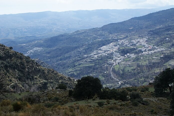
Nevertheless, it reminded us of a walking route at the other side of the main road called Sendero de las Encinas. It is still on the brochure of the town hall and on the website of Alpujarra de la Sierra, although it was not newly waymarked like the other small local walks. A few years ago we tried walking this route starting in Mecina Bombarón, but we got a little bit lost as the waymarking wasn´t very good and the path was overgrown at some parts. Now we thought we would give it a try again, walking the route in the opposite direction. From the village of Yegen we followed the Sendero de la Salud, which starts next to the play ground. This route is one of the Senderos Locales that was recently waymarked anew with wooden posts with white arrows. It follows the old Camino Real, a beautiful cobbled path that took people to Granada or Guadix on the other side of the sierra.
Where the Sendero de la Salud starts to go down, you leave this waymarked route by keeping to the left. There is an old yellow-and-white sign on a chestnut tree a few metres further on, but that is about the last one you will see for about an hour. You keep going up on the Camino Real until you see a marker post of the Sulayr route. Here you go left down a dirt track towards a holm oak grove. Here you see a few very old ´encinas´, which have given this route its name. In the distance you already see the path that will take you back to Mecina Bombarón. You get to the main road close to the Fuente de los Remedios.
It is only on the last part, where you no longer need them, that you see yellow-and-white waymarks again. The Sendero de las Encinas would normally take you over the old Roman bridge back to the vilage. Unfortunately the bridge got so badly damaged, that you need to use the main road to cross the Río Mecina.
As the GR7 does not give any problems anymore, combining the two walking connections is possible again. The two make a really varied and attractive circular walk of 14,5 kilometres. In case that you find the circular route too long or strenuous (height difference of almost 700 metres), it is possible to make use of the public transport. Don´t trust the schedule you find on the website of the local bus company ALSA too much though. The first time we tried to get on the bus to Yegen it left Mecina Bombarón at 11.15 hours, half an hour earlier than the time you see on the internet and the timetable in the town hall. After asking a few people, we understood that it mostly leaves at aroud 11.30 hours. There is a bus going from Yegen to Mecina Bombarón at 15.30 hours according to the timetable on the ALSA website, but we do not now how realiable this information is.
Related links:
All GR7 stages in the Alpujarras with maps , from the website Mancomunidad de municipios de la Alpujarra Granadina
related keywords: senderismo, rutas, wandelen, wandelingen, randonnée, promenades, wandern, wanderungen, Berchules, B&B, hotel, trektocht
Nevertheless, it reminded us of a walking route at the other side of the main road called Sendero de las Encinas. It is still on the brochure of the town hall and on the website of Alpujarra de la Sierra, although it was not newly waymarked like the other small local walks. A few years ago we tried walking this route starting in Mecina Bombarón, but we got a little bit lost as the waymarking wasn´t very good and the path was overgrown at some parts. Now we thought we would give it a try again, walking the route in the opposite direction. From the village of Yegen we followed the Sendero de la Salud, which starts next to the play ground. This route is one of the Senderos Locales that was recently waymarked anew with wooden posts with white arrows. It follows the old Camino Real, a beautiful cobbled path that took people to Granada or Guadix on the other side of the sierra.
Where the Sendero de la Salud starts to go down, you leave this waymarked route by keeping to the left. There is an old yellow-and-white sign on a chestnut tree a few metres further on, but that is about the last one you will see for about an hour. You keep going up on the Camino Real until you see a marker post of the Sulayr route. Here you go left down a dirt track towards a holm oak grove. Here you see a few very old ´encinas´, which have given this route its name. In the distance you already see the path that will take you back to Mecina Bombarón. You get to the main road close to the Fuente de los Remedios.
It is only on the last part, where you no longer need them, that you see yellow-and-white waymarks again. The Sendero de las Encinas would normally take you over the old Roman bridge back to the vilage. Unfortunately the bridge got so badly damaged, that you need to use the main road to cross the Río Mecina.
As the GR7 does not give any problems anymore, combining the two walking connections is possible again. The two make a really varied and attractive circular walk of 14,5 kilometres. In case that you find the circular route too long or strenuous (height difference of almost 700 metres), it is possible to make use of the public transport. Don´t trust the schedule you find on the website of the local bus company ALSA too much though. The first time we tried to get on the bus to Yegen it left Mecina Bombarón at 11.15 hours, half an hour earlier than the time you see on the internet and the timetable in the town hall. After asking a few people, we understood that it mostly leaves at aroud 11.30 hours. There is a bus going from Yegen to Mecina Bombarón at 15.30 hours according to the timetable on the ALSA website, but we do not now how realiable this information is.
Related links:
All GR7 stages in the Alpujarras with maps , from the website Mancomunidad de municipios de la Alpujarra Granadina
related keywords: senderismo, rutas, wandelen, wandelingen, randonnée, promenades, wandern, wanderungen, Berchules, B&B, hotel, trektocht
18 January 2010
Walking connections between Lobras and Tímar
On some walking routes in the Alpujarras you cross a river where there is no bridge. In general this should not be a problem, but at this moment of writing this can not be taken for granted. Today we found out that the rivers can be so swollen as a result of the heavy rains the past weeks, that it might be difficult or impossible to get to the other side. This we experienced while walking the GR7 between Lobras and Tímar, when we tried to cross the Río Tímar. Luckily there is now also another walking route connecting these two lovely villages, the path along the Acequia de los Castaños. In the past this was the principal walking connection. Every year less people went from one village to the other on foot, so the path became overgrown and in the end impenetrable. Thanks to an employment creation programme, this old connection was restored last year. The last day of the ´Taller de Empleo´ was on the 29th of December, right during the ´temporal´or spell of bad winter weather. Unfortunately some improvements did not withstand the heavy rains, but it is possible to follow the route without any problem. Luckily they made a proper bridge to cross the Río Tímar close to the village of Tímar. The route is not signposted, but from Lobras it is easy to find. At a crossing where you would go down towards the river following the GR7, you continue straight on along the irrigation channel. To find the route from Tímar is less easy, you need to find the old camino real next to the school building. This map gives an idea. We found it on the website with a lot of useful information on Tímar. They suggest a circular route, which will be lovely again in a few weeks or months when less water is running through the river. We can recommend the new route to everybody walking this part of the GR7. It is a more beautiful path and easier because you can avoid the steep climbing and ascending in order to cross the river. 
15 January 2010
Rain and storm damage
There is much damage to bridges and paths as a result of the spell of rough weather we have had. Heavy rain for days on end caused landslides and waterfalls. As a result a number of our walking routes are not possible at the moment. Today was the first day we went out for a short walk. We followed the GR7 out of Trevélez and saw how a great part of the path before crossing the Río Chico had disappeared and that there was nothing left of the bridge. This is just one example. From what we have heard and read in the newspapers, many dykes, ditches and retaining walls have collapsed. We will try to gather information and go out ourselves to check our routes, so that we can inform our guests in the best possible way. 
12 January 2009
Re-routing of GR7 between Bérchules and Mecina Bombarón
The GR7 between Mecina Bombarón and Bérchules has been re-routed to what was originally the plan. We don´t know why, but for many years the waymarks kept you on a dirt track, while missing out on walking along a beautiful acequia in a wooded gulley and a small path through almond groves. We´re glad they changed back to the original idea and with the current waymarking you can´t miss it. On our map you can see where you leave the track (A) and where you get back onto it (B) when you are walking from Mecina Bombarón. 
10 January 2008
Information on GR7 from our website www.elparaje.com
Here we have extracted the module GR7 from our website http://www.elparaje.com/.
Use the arrow at the bottom right to go to the next page !!
Related links:
All GR7 stages in the Alpujarras with maps , from the website Mancomunidad de municipios de la Alpujarra Granadina
Use the arrow at the bottom right to go to the next page !!
Related links:
All GR7 stages in the Alpujarras with maps , from the website Mancomunidad de municipios de la Alpujarra Granadina
Subscribe to:
Posts (Atom)